PWRS HEADLINES & NOTES:

JULY 2026 PWRS
(preliminary
7/30/26 11:59PM EDT)
BASIC STATION STATISTICS
OF CLIMATOLOGICAL DATA:
(Station databases commenced 7/1/1976)
NEAR NORMAL TEMP MEANS
WELL-ABOVE NORMAL PRECIP
TEMP MEANS:
Highs 88.8° (-0.3°)
Lows 73.5° (+1.9°)
Mean 81.2° (+0.8°)
RAINFALL - MONTHLY:
9.31" (+3.87" or 171% of normal)
2026 YEARLY PRECIP
RAINFALL 27.71"
(-1.19" or 96% of normal)
DROUGHT MONITOR LEVEL:
NONE
SNOWFALL YEARLY 4.1"
SEASONAL SNOWFALL 2025-2026 5.1"

MONTHLY STATION NEW DAILY RECORDS:
(archive with a click here)
JULY 2026
3rd - TEMPERATURE MAXIMUM 99°
4th - TEMPERATURE MAXIMUM 100°
4th - TEMPERATURE MAXIMUM MINIMUM 79°
8th - RAINFALL 2.44"
18th - TEMPERATURE MAXIMUM MINIMUM 79°
19th - TEMPERATURE TIED MAXIMUM MINIMUM 78°
23rd - RAINFALL 2.63"

NOAA PREDICTS BELOW-NORMAL
2026 ATLANTIC HURRICANE SEASON


 WEATHER-READY NATION SAFETY WEATHER-READY NATION SAFETY

BEACH & RIP CURRENT FORECASTS
Important "Know Before You Go" Info
ARCHIVE OF DAILY DATA SUMMARIES
PWRS NEW STATION RECORDS
 PWRS MONTHLY & YEAR-TO-DATE PWRS MONTHLY & YEAR-TO-DATE
CLIMATOLOGICAL SUMMARIES
PWRS MONTHLY ALMANAC
 WEATHER DESK DAILY UPDATES: WEATHER DESK DAILY UPDATES:
-> Past 24-hours Observations
-> Past 5-days & Monthly Overview
-> Daily Summaries
-> Monthly Summaries
 NWS AKQ DAILY PRECIPITATION SUMMARY
PWRS APRSWXNET OBSERVATION PAGE
| PWRS Main Weather
Subpages |
|
| observations
now & then;
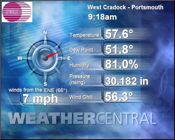
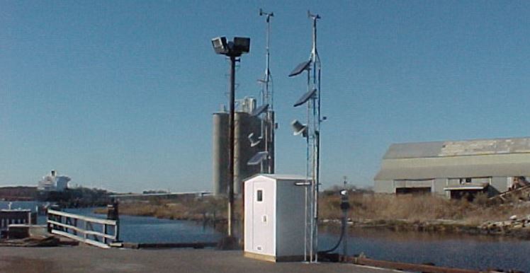
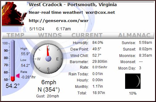
real-time observations from West Cradock in Portsmouth,
Virginia, and the world |
| quick data
links to the data files we update daily (click each phrase):
desktop graphics |
past 24-hours obs |
accumulated monthly obs |
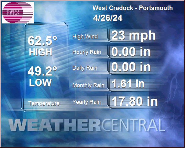
today's preliminary summary |
yesterday's summary |
current monthly summary |
monthly LCD summaries |
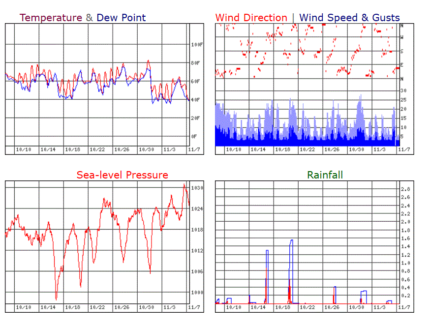
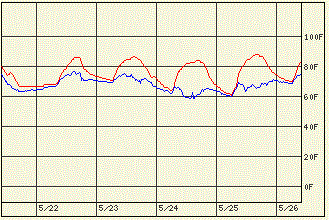
graph of obs past month |
station day-by-day almanac
|
| | webcams
cams to check local, time-lapse video, archived movies from the weather observation window
|
| trends
weather trends shown in graphical plots
|
| climate database
daily, monthly, yearly, long-term, extremes & normals
|
| forecasts & tools
get your forecast & tools for forecast here including
discussions, maps, conversion calculators, satellite images
astronomical data, tides |
| marine forecasts & tides
coastal waterway forecasts & tidal predictions,
discussions, maps, conversion calculators, satellite images
astronomical data, tides |
| model projections
computer model analyses and projections
|
| monthly summary
current data updated daily
|
| radars & satellite imagery
local, Virginia, national, and beyond!
|
| severe weather
severe weather watches and warnings locally and across
the United States
|
| tropical weather
when the tropics are alive, so are we!
|
| updates
the files we update each day
|
|
Other Station Quickpaths:
PWRS Datalogger Raw Data:
[unedited]
Today Yesterday
Full Desktop Display
All Data Summary
Almanac - Current Month
Station Daily Records
|
| |
| Search PWRS / WEB
for More Weather |
Search our site for data & documents below:
|
| |
|


 PWRS & AREA STATION METARS


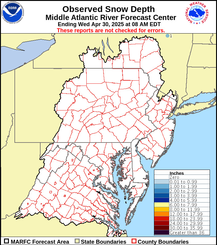 MARC Snowfall Totals Mid-Atlantic